Our Work
Proof,
not promises.
Selected projects from across our service areas. Real problems, real data, measurable results.
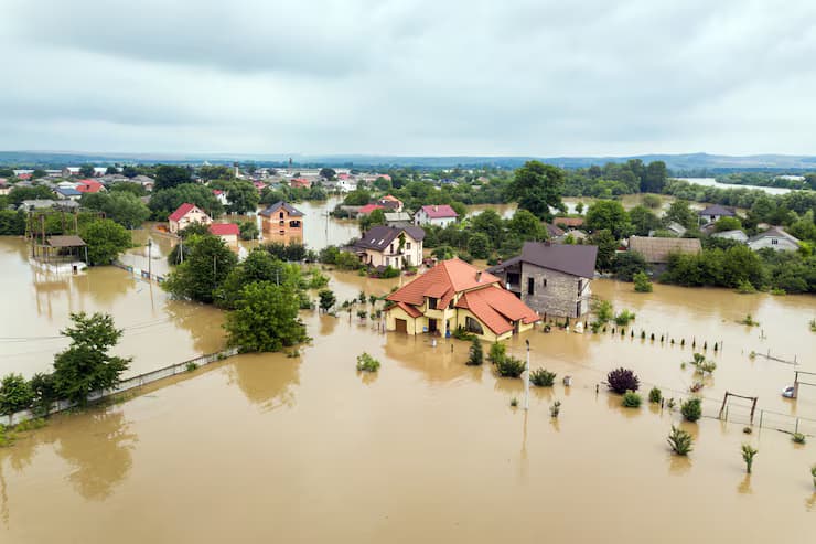
Flood Risk Predictor
Dashboard that predicts flood risk anywhere using an ML model trained on 931 global flood events. Enter a location to generate the flood risk map.
Discuss Project →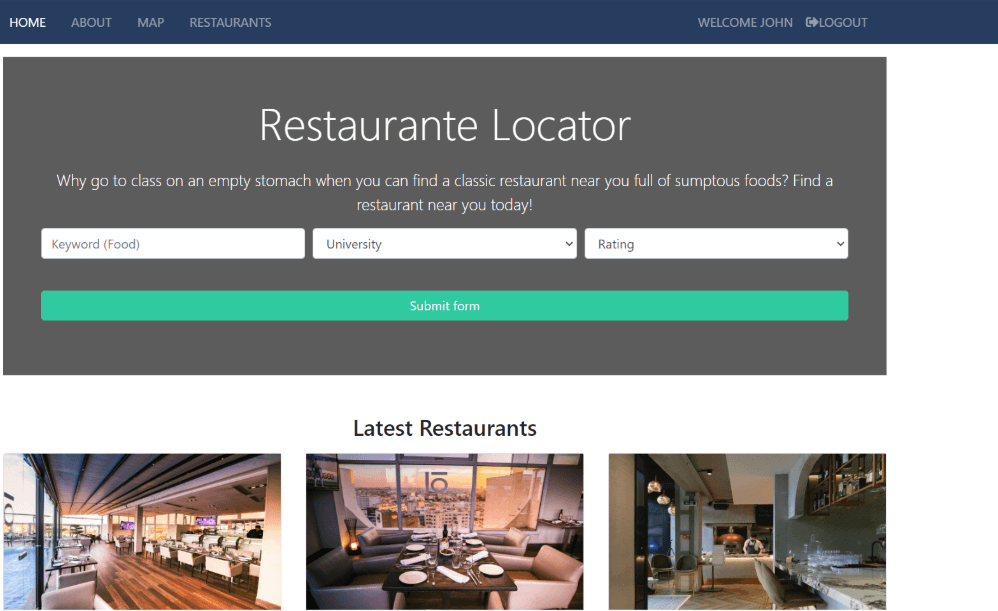
Restaurant Finder
Campus-focused app to find nearby restaurants with navigation and filtering. Allows users to filter restaurants within a distance of 1000 metres from campus.
Discuss Project →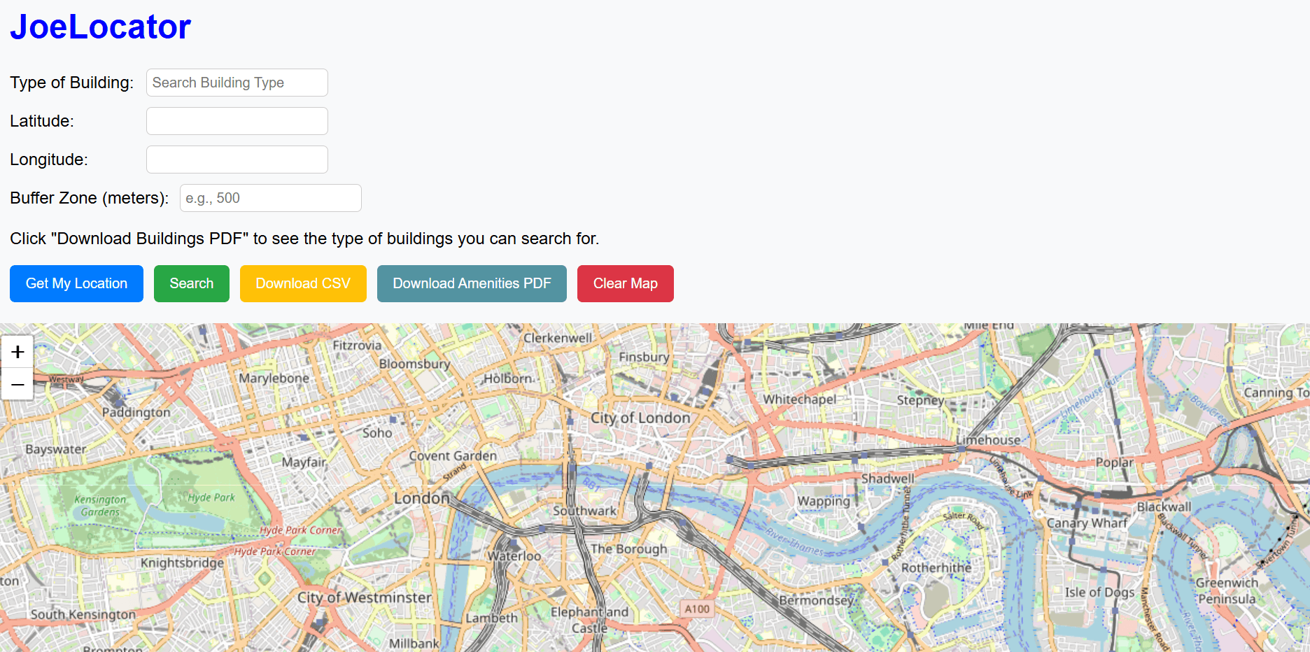
Joe Locator
A web app that allows users to search for amenities within a certain radius and download the data for further geospatial analysis.
View Joe Locator →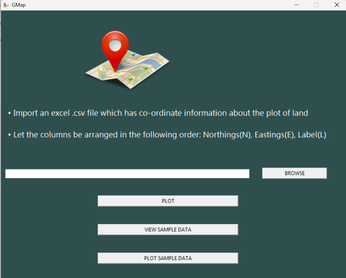
Gmap
An app that allows Ghanaian surveyors to convert local coordinates to WGS 84 and plot them automatically to Google Earth Engine.
Discuss Project →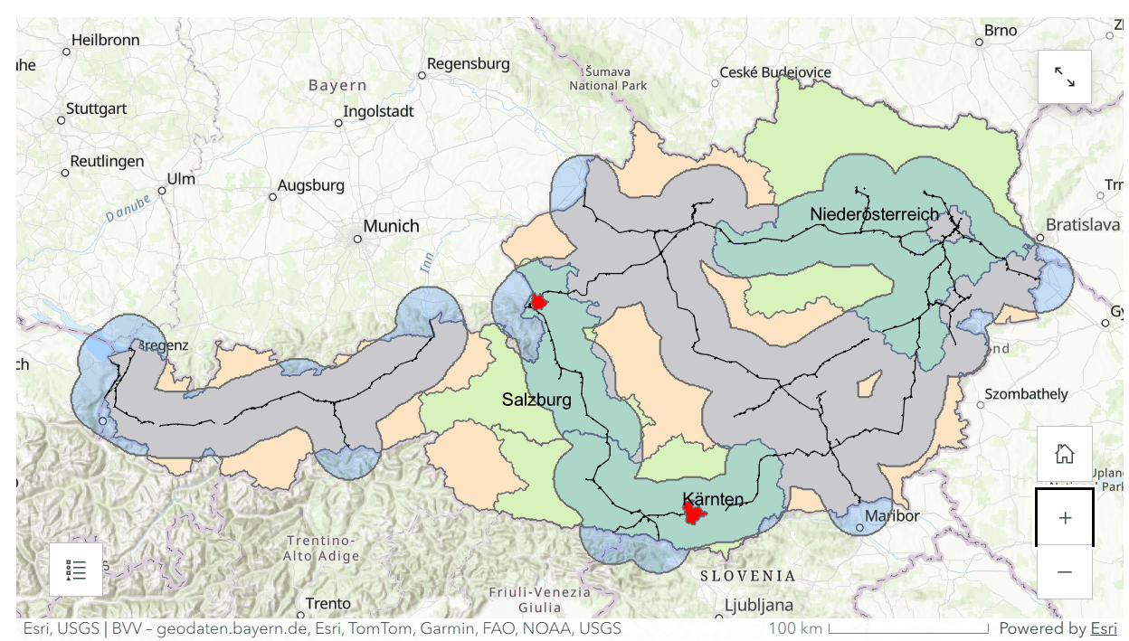
Austria University Site Suitability
Multi-criteria site suitability analysis for university placement across Austria, visualised as an interactive ArcGIS story map.
View Austria Suitability →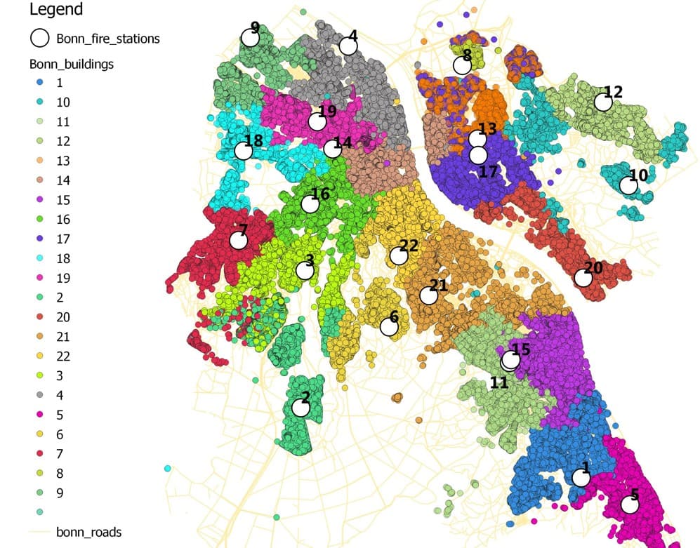
Fire Department Allocation Optimization
Spatial optimization using integer linear programming to improve emergency response efficiency in Bonn. Delivered optimal station placements considering distance and capacity constraints, integrating GIS data with Java and Gurobi.
Discuss Project →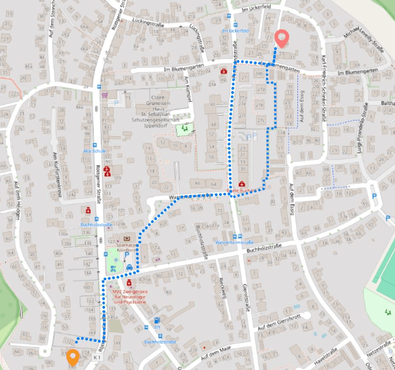
Alternative Route Search in Graph Networks
Designed and implemented a Bi-Dijkstra algorithm for computing both optimal and alternative routes in weighted graph networks.
Discuss Project →
Point Cloud Processing with Open3D
Developed a workflow to simulate and analyze noise in 3D point cloud data using Open3D, including reference geometry input, synthetic noise injection and point cloud distance evaluation.
Discuss Project →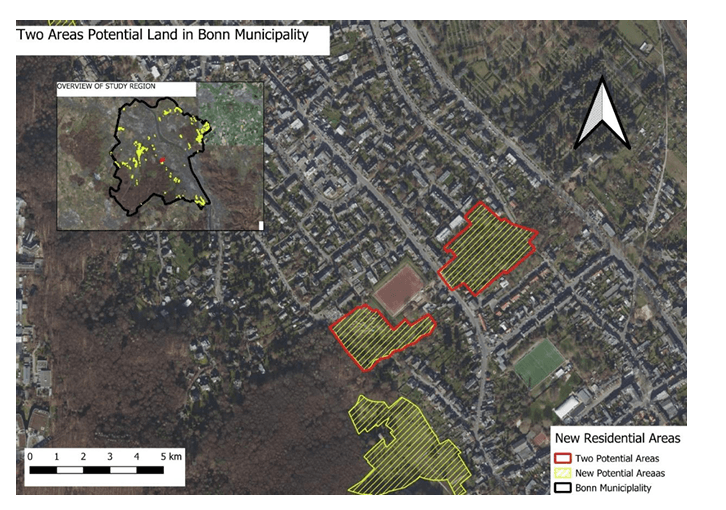
Multi-Criteria Analysis for Residential Site Selection
Applied GIS-based Multi-Criteria Analysis to identify optimal locations for new residential development in Bonn, integrating OpenStreetMap vector and raster data with proximity, transport and environmental exclusion criteria.
Discuss Project →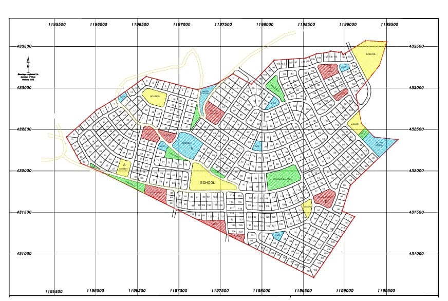
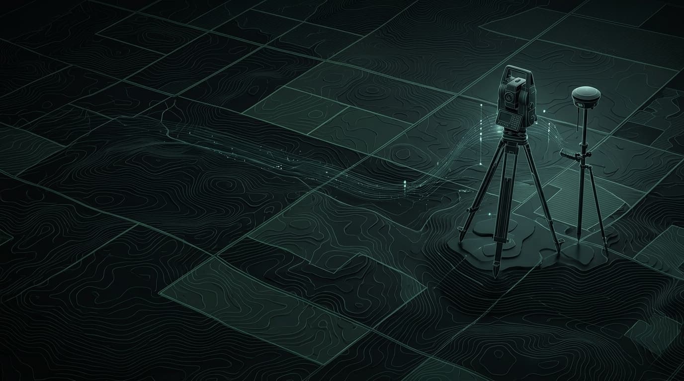
Boundary Survey, Retracement & Land Use Zoning
Comprehensive boundary and retracement survey involving parcel identification, GPS and total station field measurements, cadastral mapping and land use zoning for schools, healthcare, police, recreation and open spaces.
Discuss Project →Start a Project
Have a project in mind?
Tell us the problem. We'll tell you what's possible.